As we roll into August this week, we’re changing more than just the month on the calendar – watch for weather pattern breaks with some cooler temperatures and precipitation in some of the drought areas and hot spots we’ve been talking about over the past weeks.
We’re keeping an eye on Tropical Storm Isaias this week, as it moves through the Caribbean and may hit parts of the East Coast. No major damage is expected as it isn’t predicted to build up much over the land route it’s taking.
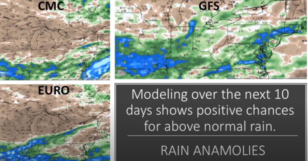
This week starts off with a large system of precipitation coming up from Texas, moving northeast through Tennessee and into the Ohio Valley. It is expected to maintain it’s strength with some thunderstorms through the heart of that system. The good news is that this will bring some rain to areas that really need it. Areas south of the Great Lakes are expected to see decent amounts of rain, more widespread than it’s been in quite some time.

Different weather models show the same generalized area will get widespread precipitation over the next 10 days. The details differ, of course, but the idea is the same – widespread rain for much of the Central US, Ohio Valley, and Northeast. By this weekend, that system will track into Buffalo and New England bringing much-needed rain to those areas. Out West, it’s expected to stay dry this week, with temperatures continuing to be above average.

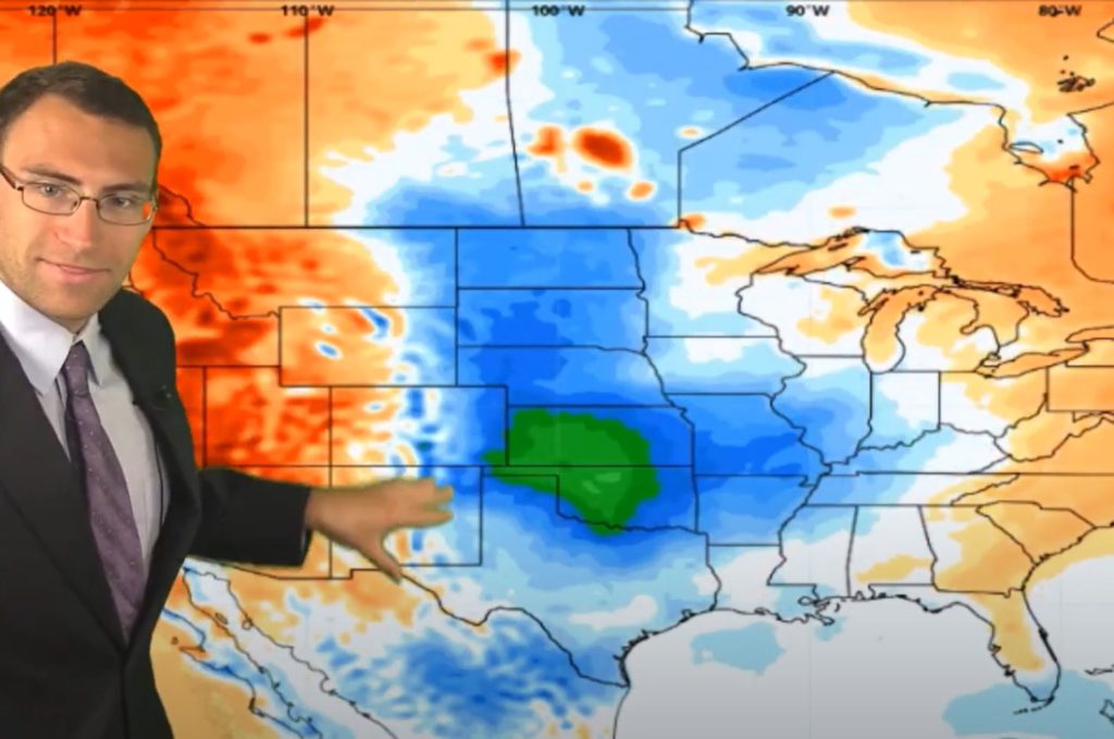
High pressure systems on each coast are pushing below average temperatures into the center of the country this week and next week. This will give the middle of the country a break from the well above average temps experienced most of July.
Cooler Temps Expected in the OH & TN Valleys in August

The first couple of weeks in August are going to bring some relief to the Central US and into the Tennessee Valley with slightly higher than average temperatures. The Great Lakes will see some breaks in the heat, but nothing major. And the good ‘ol West will remain seasonably hot and dry.
Looking for accurate weather forecasts that help with making business decisions? Contact Neoweather today!
